
01
The flown track
Flight number and date anchor the real great-circle path flown that day.
Your photos know more than you think. WDJF reconstructs your journey and shows you where you were when you took each photo — entirely on your device.
A reconstruction tool for people who photograph the window. It reads what your pictures already carry — capture times, GPS fixes, compass headings — matches them to the flight actually flown, and plays the journey back frame by frame.
Everything happens on your device. Nothing is uploaded. This is a reconstruction, not a flight record — close enough to recognise where you were, never exact enough to rely on.
No app in the air, no logging, no airplane-mode gymnastics. The desert, the coast, the wing — whatever catches your eye. Every shot quietly records when it was taken and which way you were facing.


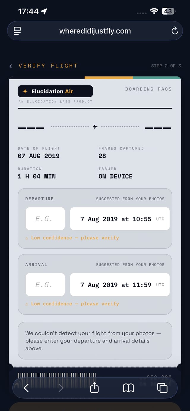
Pick the flight's photos and the tool issues you a boarding pass built from them — date, duration, frames captured, departure and arrival suggested from the pictures themselves. Where it isn't sure, it says so and asks you to verify.
ISSUED ON DEVICE · NOTHING UPLOADED
App screenshots show the current in-app palette — the app recolour is a separate pass.
The reconstruction plays frame by frame: flip between PHOTO and MAP, follow the full route drawn solid where a photo carried a real GPS fix and dashed where the timestamp placed it, with heading and sun angle for every shot.
The phone's GPS locked on the ground and never updated at altitude, so all thirty-odd frames carry the departure gate's coordinates — the Red Sea, Athens and London all tagged “Mumbai.” The places here come instead from each shot's timestamp, matched to the flown track, cross-checked against what's actually in the frame.
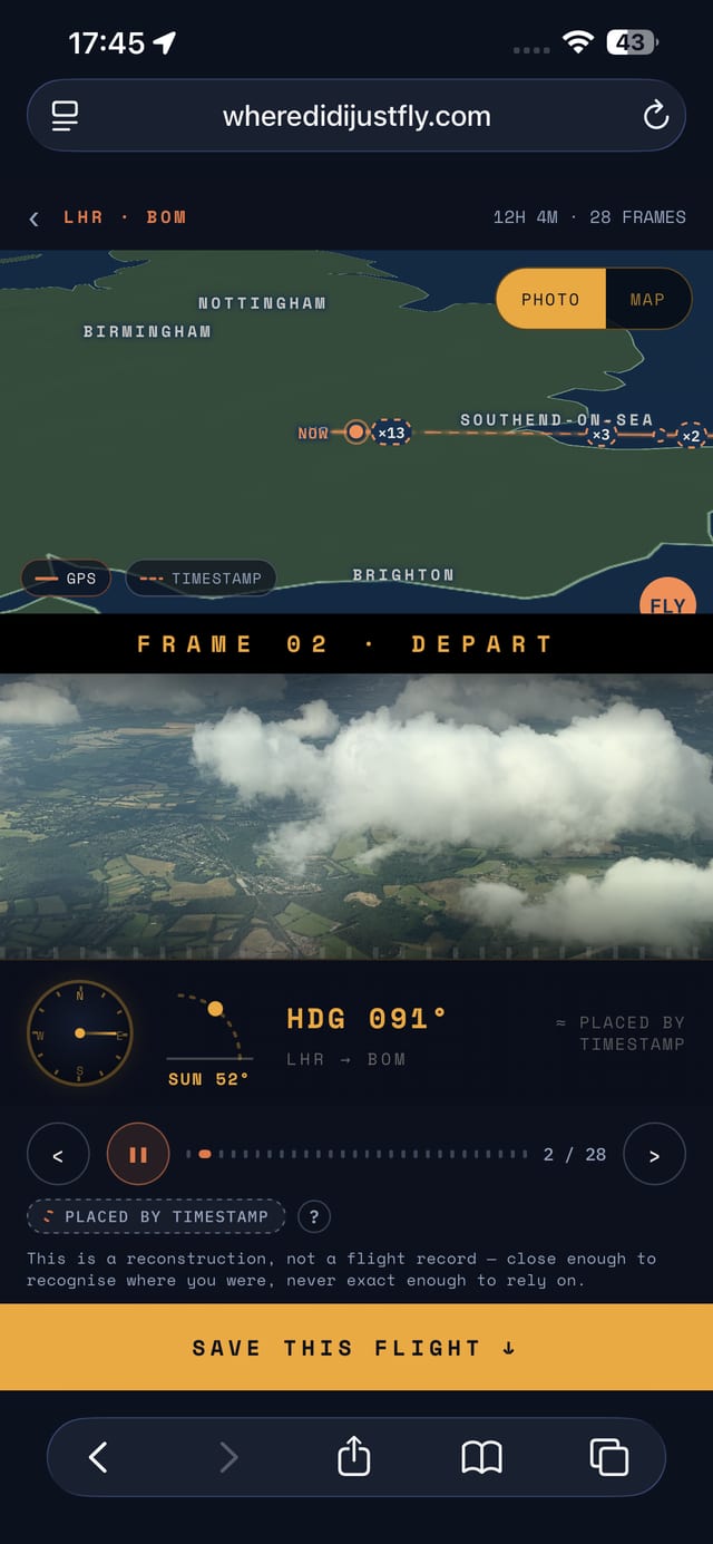
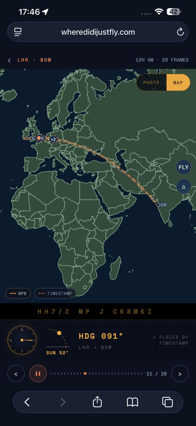
Flight number and date anchor the real great-circle path flown that day.
Each shot's capture time joins to a point on the track — even when the GPS lied.
The compass bearing says which way you were looking — out the left side, at the coast, into the sun.
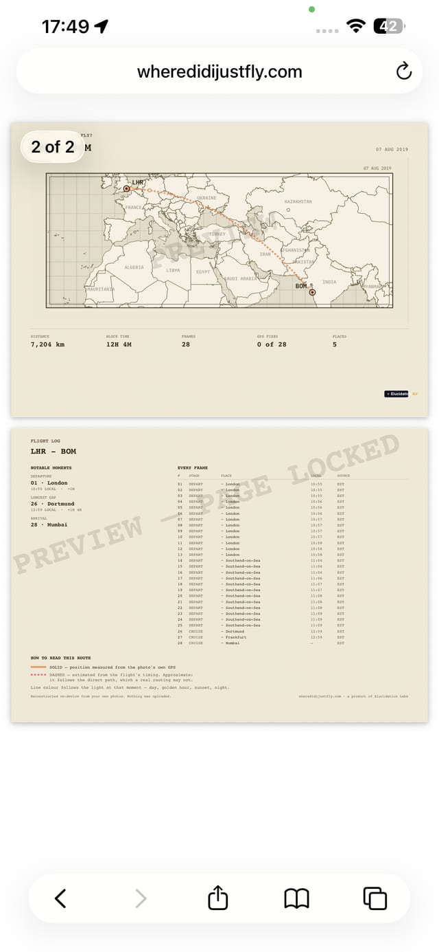
Save the flight to your gallery, or export the full flight log: the atlas-plate route map with every frame plotted in position, camera heading and sun angle logged for each shot, GPS-confirmed frames marked apart from ones placed by timestamp, the story of the flight told phase by phase — plus a QR code on the card itself that reopens the live, interactive reconstruction, not just a flat image.
SAVE THIS FLIGHT · SCAN TO REOPEN LIVE · PRINT PDF
Every flight, every photo, no trip limit, no login wall. Snap, load, and watch it come back — that part of WDJF doesn't have a price tag and isn't going to get one.
Free sharing gets you a screenshot. £4.99 gets you the full flight log: the atlas-plate route map with every frame plotted in position, camera heading and sun angle logged for each shot, GPS-confirmed frames marked apart from ones placed by timestamp — plus a QR code on the card itself that reopens the live, interactive reconstruction, not just a static image. One-off, per flight. No subscription.
Your photo library — nothing else. It reads what your photos already carry (capture time, GPS fix, compass heading) to work out where you were. It never asks for your location live, never runs in the background, and never talks to a server: the whole reconstruction happens on your device.
At altitude, sealed in a metal tube, your phone can't hear GPS satellites — so it keeps the last fix it got on the ground. Fly Mumbai to London and the Red Sea, Athens and the Alps all get tagged “Mumbai.” WDJF works around this by reading each photo's timestamp instead, matched against the flight actually flown that day.
It says, honestly. Photos with a real GPS fix are marked solid; the rest are placed by timestamp and marked dashed — you can always tell which is which. Where a fix is too rough to name a place confidently, WDJF says “near” instead of guessing “at.”
Not yet. WDJF reads still photos only — JPEG and HEIC carry the GPS and timestamp data it needs; other image formats are accepted but rarely contain useful location data. If a Live Photo is involved, only the still frame is used — the paired video clip is set aside, not processed.
What matters isn't really the format, it's whether the file kept its metadata. Straight-off-the-phone JPEG and HEIC are the ones that work, because they carry the capture time, GPS fix and compass heading the reconstruction runs on. Other image formats are accepted, but a screenshot, a PNG export or anything that has been through a messaging app has usually had that information stripped — and a photo with no timestamp is a photo WDJF can't place.
Not yet — WDJF is a web app for now. Open it in your phone's browser and it works the same way, including offline once it has loaded. There's no App Store or Play Store listing to link to, so we're not pretending otherwise.
Mumbai → Arabia → the Red Sea → Egypt → Athens → the Adriatic → the Alps → London.
DRAWN FULLY DASHED — EVERY FRAME ON THIS FLIGHT WAS PLACED BY TIMESTAMP, NONE BY GPS.

A Kuwait Airways A330 taxiing past the terminal at Chhatrapati Shivaji Maharaj. The start line.
Center-pivot irrigation discs scratched into the desert — crops drawn from deep fossil water, unmistakable from altitude.

Turquoise reef and sandbar against a bare desert coast, as the track crossed toward Egypt.

A great port on a long curving shore — the Mediterranean edge of the Nile delta, most likely the approaches to Alexandria.
The swarm of anchored ships gives it away: Piraeus, with Athens climbing the mountains behind.

Wing over the Greek coast and islands — deep blue water and dry headlands, the classic Aegean.

Long, thin, parallel limestone islands — the Kornati archipelago. No coastline pleats like it.

Snow on the high ridges as the camera swung northwest — the track bending its last arc toward London.

Flat farmland and bright mineral ponds through the haze — the near-Continent, letting down.
The Thames coiling round the Isle of Dogs, Canary Wharf, the O2 — home, nine and a quarter hours after Mumbai.
SAVED FLIGHTS LIVE IN THE APP'S GALLERY — OPEN THE REAL THING
We're building this out properly — tell us what you'd want to know mid-flight, or just say hello. Every reply reads.
WEB APP ONLY FOR NOW · NO APP STORE OR PLAY LISTING YET